On a moonlit evening with 14 college students, I parked the university van at a trailhead where we put on our snowshoes and began our somewhat challenging hike up Rib Mountain toward the summit. This was just one of several years where I led students on a hike upon this snow-covered Wisconsin mountain as a culminating activity for a snowshoeing course. My goal was to reach the top and prepare a traditional Wisconsin brat supper for our group.
The brat is a sausage… that when cooked on a charcoal grill and topped with ketchup, mustard, relish and onions, makes the perfect feast for a snowshoeing hike. How I looked forward to this annual event on this magnificent land feature.
However, hiking up Rib Mountain is by no means compared to climbing Mount Everest. Rib Mountain, referred to in the past as Rib Hill, is only 1,924 feet above sea level. When compared to eastern and western standards, mountains in Wisconsin are basically really big hills. Rib earned the title “mountain” because the height from the landmass below to the summit is 670 feet, the greatest distance of any hill in the state. Rib Mountain is the fourth highest landmark in Wisconsin, with Timm’s Hill being the highest at 1,952 feet.
Located in north central Wisconsin just southwest of the city of Wausau, the roughly 4-mile long Rib Mountain is one of Wisconsin’s glacial miracles, made up of 1.7 billion-year-old rock called quartzite. According to the WI Department of Natural Resources- Bureau of Parks and Recreation, “this billion-year-old hill is one of the oldest geologic formations on earth.” Large truck-size quartzite boulders dot the landscape near the summit.
Considering that Rib Mountain is a big hill with lots of rock, it is also a wonderland for snowshoeing and downhill skiing in winter, and a forested paradise for hiking, biking and picnicking in the other 3 seasons.
Rib Mountain State Park
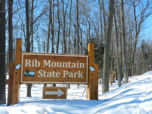
Rib Mountain State Park sign
Most of Rib Mountain is state owned and is home to the 1,627-acre Rib Mount State Park. With 14½ miles of hiking trails, the summit is topped with a 60-foot observation tower, two observation decks facing north and south, and two exceptionally large boulder formations called the Queen’s and King’s Chairs.
These features are easily accessible by car via the 2.5-mile Park Road that circles at the summit. The south side of the hill and some areas to the west are comprised of a web-like trail system for hiking and snowshoeing, and the north side in winter is exclusively for downhill skiing.
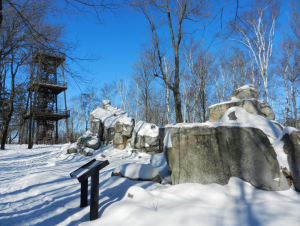
The quartzite boulders – Queen and King Chairs and 60-foot observation tower atop Rib Mountain
Granite Peak (its name comes from red granite that is indigenous to Marathon County where Rib Mountain is located) is Wisconsin’s largest downhill ski area with 75 runs including 3 mogul runs on 220 skiable acres. It hosts a 700-foot vertical drop, 7 ski lifts including 3 high-speed lifts, and welcoming chalets with dining, souvenirs and ski rentals. Granite Peak is privately owned, but the hill is rented from the WI DNR.
Many Snowshoe Trails
In spring, trillium, hawkweed, and Canada mayflower dot the landscape with occasional jack-in-the-pulpit found here and there. Autumn explodes in splendid color with stands of maple, birch and quaking aspen making the forest ceiling appear laced with gold as if touched by King Midas. And in winter, the hill is cloaked in white. Majestic pine, spruce, and eastern hemlock branches are laden with snow. The air is crisp and the landscape is exceptionally picturesque.
While the north side of the mountain is filled with excitement by skiers, the southern hill is unpopulated, quiet, and scenic. It belongs to the slow-paced snowshoer. Hiking trails provide great opportunities for snowshoeing on a variety of terrain where the hiker will encounter changing forests, rock formations of varying sizes, and angled slopes with mild to steep climbs. Nine different trails are identified with color-coded markers. Color codes are referenced on a trail map available at the park’s vehicle entrance. Reference the Rib Mountain State Park Winter Map online at http://dnr.wi.gov/topic/parks/name/ribmt/pdfs/ribmtnwinter.pdf.
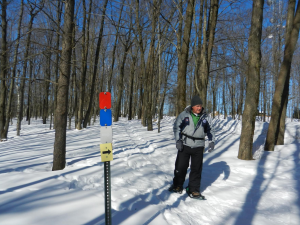
Rib Mountain trails are identified by color-coded markers
Those who like to explore landmarks should snowshoe on the Blue, Green and Gray trails starting at the summit where they will be among many mammoth boulders and the observation tower that sits at the top (tower closed to climbers in winter). These trails traverse up and down snow-covered rock steps put in place in the 1930’s by the Civil Conservation Corp. There are also great rock outcrops allowing for spectacular views.
The adventurous hiker should consider taking the Red Trail. It encompasses the area down and around from the summit to the ranger station, meandering through a mixed northern hardwood and conifer forest with an occasional view of landmasses below. Snowshoeing on varying terrain with some steep slopes, crossing just above some very impressive talus slopes made by fallen bits of quartzite boulders from thousands of years of gravity at play are some of the challenges on the Red Trail.
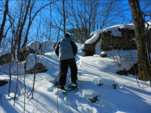
Snowshoeing up steep slopes and over large boulders is typical on Rib Mountain
The long-distance hiker with strong lungs and a good heart can go the distance by taking the four-mile Yellow Trail. This trail runs down the southeast side of Rib Mountain paralleling the park road and returning west requiring a steep hike uphill. There is an option of taking one of four circles on the yellow trail. Whatever circle chosen, the hiker will eventually head back west and ascend back up Rib Mountain. The entire yellow trail is definitely a workout. Newer trails on the far west end of Rib Mountain offer some spectacular hiking opportunities as well.
The Homestead Loop Trail is a little over a 1¼-mile loop that passes by an old homestead foundation from the late 1800’s and through a magnificent hemlock stand. The Turkey Vulture Trail traverses around an old quarry where turkey vultures roost on quarry walls in the summer. After 1¼ miles, the trail joins the Homestead Loop for the trek back to the parking area. The Dynamite Trail is only a quarter-mile long and connects to the Turkey Vulture and Homestead Loop. Its name comes from the former location of a dynamite storage facility used during historic mining operations run by 3M.
The Homestead Loop also connects with Quarry Trail, a looped trail that can also be accessed from the Red Trail up by the summit. The Quarry Trail leads to the old quartzite quarry. The only trail not open during the winter is a portion of the Gray Trail that runs across the north side of the hill. That segment is closed during downhill ski season due to its proximity to the ski hill.
Snowshoeing Events on the Mountain
The Friends of Rib Mountain State Park sponsor two snowshoeing events on the hill each year. A daytime snowshoe walk is scheduled on a Saturday in early January, and a candlelight snowshoe walk is held on a Saturday in mid-February. The upper trails are illuminated with candles, giving the appearance as if a thousand Tinkerbells invaded Rib Mountain. Following the programs are a campfire and hot chocolate… a perfect community event to get visitors out on snowshoes.
There is no cost for either event. But a daily park sticker needs to be purchased if attending the events or visiting on another day. Or, get an annual sticker if planning to return or visit other Wisconsin state parks. For park sticker information, go online to http://dnr.wi.gov/topic/parks/admission.html. For information about Rib Mountain State Park, go online to http://dnr.wi.gov/topic/parks/name/ribmt/ or call 715 842-2522.
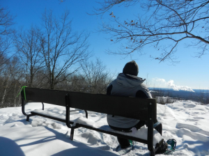
Sunrise Lookout… a spot with a view
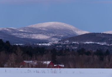
A favorite spot of mine on Rib Mountain off the Yellow and Gray trails is Sunrise Lookout. I often sit on this rock and enjoy the southeast view below with farmland, a nearby community and a neighboring hill in sight. Just past Cobbler’s Knob by a few hundred yards, I climb a steep boulder and then I side-step down another rock formation that drops onto Sunrise Lookout. A bench is located there. Go ahead… you can use it since there is plenty of room for the both of us.



Leave a Comment